 vesseltracker.com
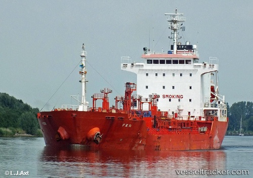
Vessel KARADENIZ POWERSHIP AYBERK BEY IMO: 9359600, MMSI: 636021601 Chemical/Oil Products Tanker
UTC, 6.32013, -10.89327, course: 132, speed: 0.4
UTC, 6.32022, -10.89285, course: 161, speed: 0.2
2026-01-26 15:52:03 UTC, 6.32070, -10.89285, course: 168, speed: 0
Live AIS position:
UTC. Near Monrovia),
updated 2026-01-26 15:52:03 UTC.
Find the position of the vessel KARADENIZ POWERSHIP AYBERK BEY on the map. The latter are known coordinates and path.
marine traffic ship tracker show on live map
The current position of vessel KARADENIZ POWERSHIP AYBERK BEY is 6.32070 lat / -10.89285 lng. Updated: 2026-01-26 15:52:03 UTCCurrently sailing under the flag of Liberia
KARADENIZ POWERSHIP AYBERK BEY built in 2006 year
Deadweight:
12934 tDetails:
Last coordinates of the vessel:
UTC, 6.32033, -10.89288, course: 132, speed: 0.3UTC, 6.32013, -10.89327, course: 132, speed: 0.4
UTC, 6.32022, -10.89285, course: 161, speed: 0.2
2026-01-26 15:52:03 UTC, 6.32070, -10.89285, course: 168, speed: 0